


Kulpsville 🇺🇸
-
Nautical Twilight begins:04:54 amSunrise:06:00 am
-
Sunset:07:57 pmNautical Twilight ends:09:02 pm
-
Moonrise:02:36 am
-
Moonset:12:17 pm
-
Moon over:07:26 am
-
Moon under:07:43 pm
-
Visibility:48%
-
 Third Quarter Moon
-
Distance to earth:367,646 kmProximity:89.3 %
Moon Phases for Kulpsville
-
average Day
-
minor Time:01:36 am - 03:36 am
-
major Time:06:26 am - 08:26 am
-
minor Time:11:17 am - 01:17 pm
-
major Time:
 06:43 pm -
08:43 pm
06:43 pm -
08:43 pm
Tide Clock
Tide Graph
Times
| Tide | Time | Height |
|---|---|---|
| low | 02:36 am | 1.05 ft |
| high | 08:10 am | 7.25 ft |
| low | 03:32 pm | 0.89 ft |
| high | 09:00 pm | 6.3 ft |
| Date | Major Bite Times | Minor Bite Times | Sun | Moon | Moonphase | Tide Times |
|---|---|---|---|---|---|---|
|
Wed, 01 May
|
06:26 am -
08:26 am
06:43 pm -
08:43 pm
|
01:36 am -
03:36 am
11:17 am -
01:17 pm
|
R: 06:00 am S: 07:57 pm |
R: 02:36 am S: 12:17 pm |
Third Quarter Moon |
low: 02:36 am
, 1.05 ft
high: 08:10 am
, 7.25 ft
, Coeff: 116
low: 03:32 pm
, 0.89 ft
high: 09:00 pm
, 6.3 ft
, Coeff: 90
|
|
Thu, 02 May
|
07:21 am -
09:21 am
07:35 pm -
09:35 pm
|
02:10 am -
04:10 am
12:33 pm -
02:33 pm
|
R: 05:59 am S: 07:58 pm |
R: 03:10 am S: 01:33 pm |
Third Quarter Moon |
low: 03:39 am
, 1.02 ft
high: 09:15 am
, 7.25 ft
, Coeff: 116
low: 04:29 pm
, 0.82 ft
high: 09:59 pm
, 6.63 ft
, Coeff: 99
|
|
Fri, 03 May
|
08:13 am -
10:13 am
08:26 pm -
10:26 pm
|
02:38 am -
04:38 am
01:48 pm -
03:48 pm
|
R: 05:57 am S: 07:59 pm |
R: 03:38 am S: 02:48 pm |
Waning Crescent |
low: 04:44 am
, 0.92 ft
high: 10:18 am
, 7.25 ft
, Coeff: 116
low: 05:25 pm
, 0.69 ft
high: 10:57 pm
, 7.02 ft
, Coeff: 109
|
|
Sat, 04 May
|
09:03 am -
11:03 am
09:15 pm -
11:15 pm
|
03:03 am -
05:03 am
03:04 pm -
05:04 pm
|
R: 05:56 am S: 08:00 pm |
R: 04:03 am S: 04:04 pm |
Waning Crescent |
low: 05:47 am
, 0.75 ft
high: 11:18 am
, 7.28 ft
, Coeff: 116
low: 06:19 pm
, 0.59 ft
high: 11:51 pm
, 7.45 ft
, Coeff: 121
|
|
Sun, 05 May
|
09:53 am -
11:53 am
10:06 pm -
12:06 am
|
03:27 am -
05:27 am
04:19 pm -
06:19 pm
|
R: 05:55 am S: 08:01 pm |
R: 04:27 am S: 05:19 pm |
Waning Crescent |
low: 06:47 am
, 0.56 ft
high: 12:14 pm
, 7.28 ft
, Coeff: 116
low: 07:12 pm
, 0.49 ft
|
|
Mon, 06 May
|
10:44 am -
12:44 pm
10:58 pm -
12:58 am
|
03:53 am -
05:53 am
05:36 pm -
07:36 pm
|
R: 05:54 am S: 08:02 pm |
R: 04:53 am S: 06:36 pm |
New Moon |
high: 12:43 am
, 7.84 ft
, Coeff: 132
low: 07:45 am
, 0.39 ft
high: 01:08 pm
, 7.25 ft
, Coeff: 116
low: 08:02 pm
, 0.49 ft
|
|
Tue, 07 May
|
11:38 am -
01:38 pm
11:22 pm -
01:22 am
|
04:21 am -
06:21 am
06:55 pm -
08:55 pm
|
R: 05:53 am S: 08:03 pm |
R: 05:21 am S: 07:55 pm |
New Moon |
high: 01:33 am
, 8.07 ft
, Coeff: 138
low: 08:40 am
, 0.3 ft
high: 01:59 pm
, 7.15 ft
, Coeff: 113
low: 08:51 pm
, 0.52 ft
|


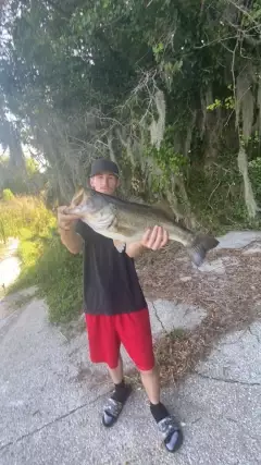
uploaded by: D2Turnt

uploaded by: PT Edward fisher

uploaded by: Charlie Pifer

uploaded by: Charlie Pifer

uploaded by: Charlie Pifer

uploaded by: Charlie Pifer

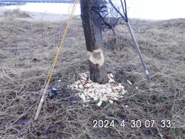
uploaded by: bariu

uploaded by: bariu

uploaded by: bariu
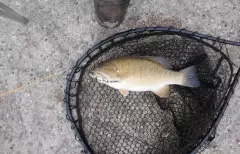
uploaded by: PT Edward fisher
Best Fishing Spots in the greater Kulpsville area
Beaches and Bays are ideal places for land-based fishing. If the beach is shallow and the water is clear then twilight times are usually the best times, especially when they coincide with a major or minor fishing time. Often the points on either side of a beach are the best spots. Or if the beach is large then look for irregularities in the breaking waves, indicating sandbanks and holes. We found 2 beaches and bays in this area.
Camp Kweebec Dam - 13km , Camp Delmont Dam - 14km
Harbours and Marinas can often times be productive fishing spots for land based fishing as their sheltered environment attracts a wide variety of bait fish. Similar to river mouths, harbour entrances are also great places to fish as lots of fish will move in and out with the rising and falling tides. There are 1 main harbours in this area.
Betzwood Marina - 17km
We found a total of 86 potential fishing spots nearby Kulpsville. Below you can find them organized on a map. Points, Headlands, Reefs, Islands, Channels, etc can all be productive fishing spots. As these are user submitted spots, there might be some errors in the exact location. You also need to cross check local fishing regulations. Some of the spots might be in or around marine reserves or other locations that cannot be fished. If you click on a location marker it will bring up some details and a quick link to google search, satellite maps and fishing times. Tip: Click/Tap on a new area to load more fishing spots.
Fischers Dam - 2km , Benesh Dam - 5km , Hallman Dam - 6km , Creamery Dam - 6km , Country Club Dam - 6km , Groff Dam - 7km , Club Dam - 7km , Hilltown Dam - 8km , Gross Dam - 8km , Keller Dam - 8km , Landis Dam - 8km , Bergey Dam - 9km , Wright Dam - 9km , Railroad Creek Dam - 10km , Taylor Dam - 10km , Perkiomen Bridge - 11km , Collegeville Dam - 11km , Gerhart Dam - 11km , Mermaid Lake - 11km , Kratz Dam - 11km , Marklelys Pond - 12km , Artcraft Recreation Association Dam - 12km , Forest Park Dam - 12km , Thompson Dam - 12km , Salford Dam - 12km , Leidy Dam - 12km , Ridge Valley Dam - 12km , Worthington Dam - 13km , Keasby Mattison Dam - 13km , Craft Dam - 13km , McKean Dam - 13km , Cornog Dam - 13km , Saw Mill Dam - 13km , Camp Kweebec Dam - 13km , Hoopes Dam - 13km , Lake Aree Dam - 14km , Pine Run Covered Bridge - 14km , Indian Head Park Dam - 14km , Peace Valley Dam - 14km , Foedisch Dam - 14km , Dager Dam - 14km , Camp Delmont Dam - 14km , South Perkasie Covered Bridge - 14km , Hart Lake Dam - 15km , Moyer Dam - 15km , Morristown Dam - 15km , William F Danne Hower Bridge - 15km , Philadelphia Electric Dam - 15km , Norristown Dam Bridge - 15km , Pine Run Dam - 15km , Barbadoes Island - 15km , Mehler Dam - 15km , Brey Dam - 15km , Reed Dam - 15km , Lock Linden Dam - 15km , Lock Alsh Reservoir Dam - 15km , Lock Alsh Dam - 15km , Creek Dam - 15km , Wetherills Dam - 16km , Rittenhouse Dam - 16km , Deep Creek Dam - 16km , Upper Knickerbocker Dam - 16km , Doctor Jackson Dam - 16km , Knight Dam - 16km , Moods Covered Bridge - 16km , Fehl Dam - 16km , Green Lane Reservoir Dam - 16km , Neshaminy SCS Dam 611 - 16km , Betzwood Marina - 17km , Walsh Dam - 17km , Oaks Dam - 17km , Betzwood Bridge - 17km , Lakeview Dam - 17km , Long Dam - 17km , Black Rock Dam - 18km , Sherry Lake - 18km , Morris Dam - 19km , French Dam - 19km , Plymouth Dam - 19km , Middle Dam - 19km , Phoenixville Dam - 19km , Pickering Creek Dam - 19km , Martins Dam - 20km , Knox-Valley Forge Dam Covered Bridge - 20km , Martins Dam Bridge - 20km , Upper Dam - 20km
Comments